
This page contains affiliate links. Please read our disclosure for more info.
La Gomera is one of the smallest and quietest Canary Islands in Spain. The lack of coastal road or international airport on this mountainous island has kept mass tourism away.
It’s a fantastic, diverse hiking destination with marked trails, stunning views, and mild weather year-round—perfect for some winter sun.
A highlight is the Parque Nacional de Garajonay, a UNESCO World Heritage site in the centre of the island, featuring an ancient, lush laurel forest.
We spent a week on the island in March. Hiking in La Gomera often features steep trails, but we focused on finding the best easy walks and have included our favourites below.
I’ve also shared where we stayed, how to get there, and a map of everywhere we visited.
Contents
What to Expect Hiking La Gomera
Terrain
La Gomera is a mountainous island with no coastal road. The towns are located in valleys, and to get anywhere, you have to drive up steep, winding roads and then back down again.
It’s a small island and nowhere is more than 90 minutes away, but the driving does feel arduous, especially if you get carsick like me. The views are often spectacular, though!
There are buses, and you could do some one-way hikes that way. We rented a car, which gave us a lot more flexibility. See below for more transport details.
Due to its terrain, walks in La Gomera usually have steep ascents and descents, but the ones we did had more moderate elevation gain.
Weather
La Gomera has mild winters, so it’s a popular time for Germans and Brits to visit.
In mid-March, we had temperatures of 18-20ºC on the coast during the day, but it was often windy so it could feel cooler.
In the mountains in the centre of the island, it was much colder (6-12ºC) and almost always cloudy. When the sun did come out, it was perfect hiking weather.
Facilities
We didn’t come across any public toilets on La Gomera, so bear that in mind when heading out. Buying an inexpensive espresso is a good way to use cafe facilities before you start a walk.
There were also toilets at the visitor centre, Centro de Visitantes Juego de Bolas, near Agulo. But we didn’t hike near there—just drove through.
We found service in restaurants was often very slow, so be prepared for that if you are starving after a walk. Take snacks and water on your hikes.
Hiking in La Gomera Resources
We used the book, La Gomera Rother Walking Guide, which includes 73 walks on the island with detailed instructions.
You can also download the GPX files for each walk, which we imported into AllTrails (or Rother has an app).
Most of the hikes are pretty challenging, so the book is most worthwhile for serious hikers. It does have some easy walks, though.
AllTrails is our go-to app for finding hiking trails all over the world, and we used it a lot in La Gomera. We have a Plus account, which allows us to download maps for offline use.
Easy Walks in La Gomera
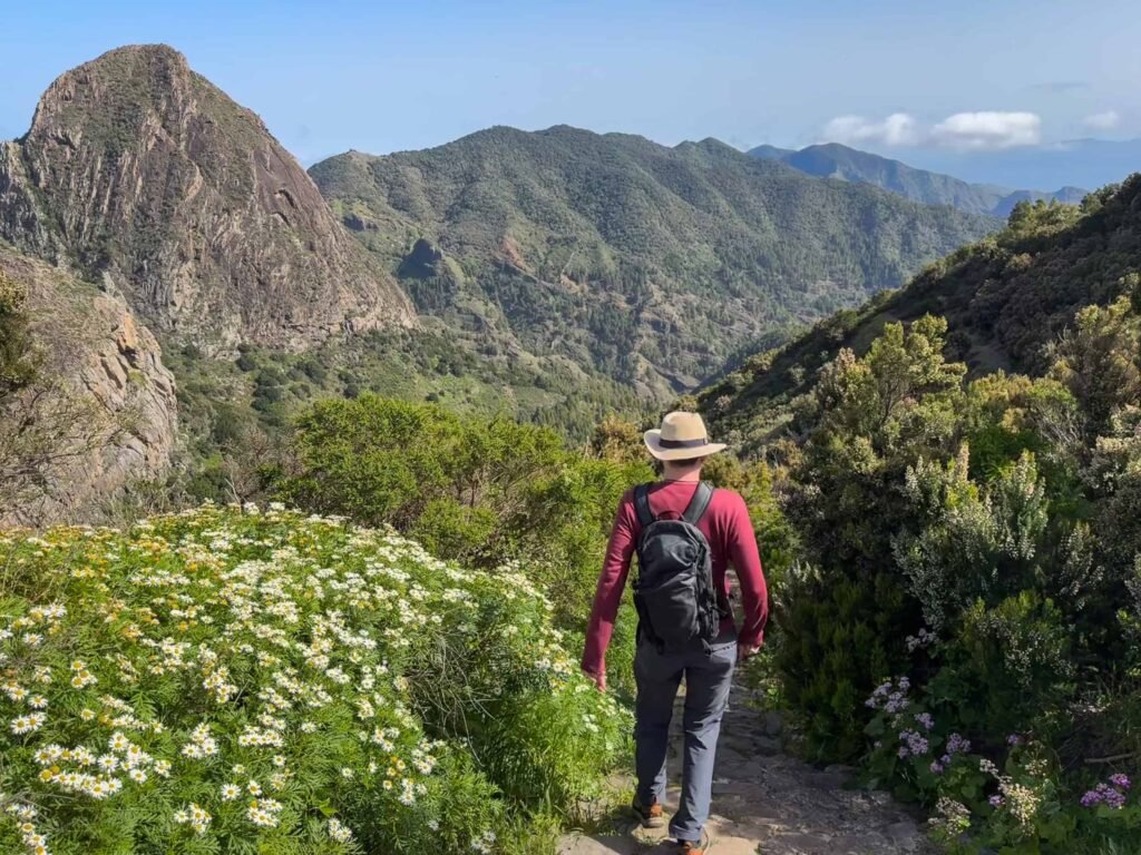
1) Las Creces in Parque Nacional de Garajonay

Walking in the Parque Nacional de Garajonay is a must on La Gomera, and it’s the best place for easy walks.
It’s located at the higher elevations of the centre and covers 10% of the island in rare laurel forest.
This misty, mossy forest is an atmospheric place for a walk, with many trails crisscrossing the park.
It’s much colder in the park than on the coast—for us it was 6-7ºC at the higher parts vs 19ºC on the coast.
It was also very cloudy there our entire week, so we never bothered with the walk to Alto de Garajonay, the island’s highest peak at 1487m, as we wouldn’t have been able to see a thing.
Instead, we did an easy walk through the forest in Las Creces picnic area (a 30-minute drive from Valle Gran Rey, where we were staying).
On AllTrails it’s called Las Creces – Ruta 5 – GR131. The 4.4km walk took us about an hour from the parking (by the road nearest to La Creces—see AllTrails, as it’s not marked on Google Maps).
It was mostly flat with only a few gentle hills. The trail was muddy and uneven, though, so good shoes are a must.

We then added on a bit by walking across the road and through more forest to Mirador Risquillos de Corgo, with its view down to Vallehermoso. There are plenty of options for longer walks.
After our walk, we had a traditional lunch in Las Hayas (see below). You could also walk there from Las Creces for a longer route.
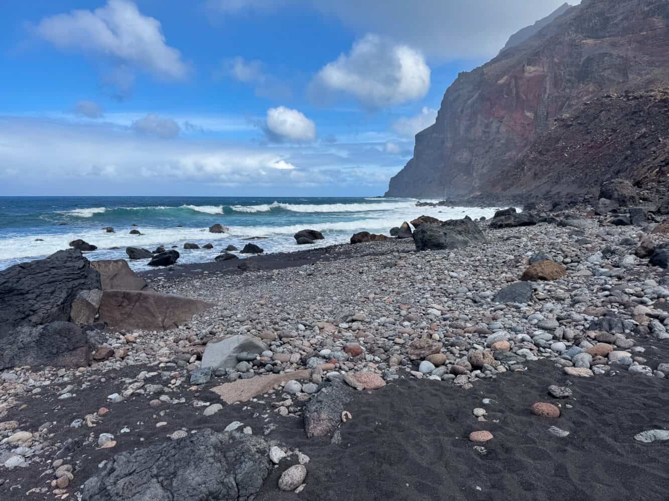
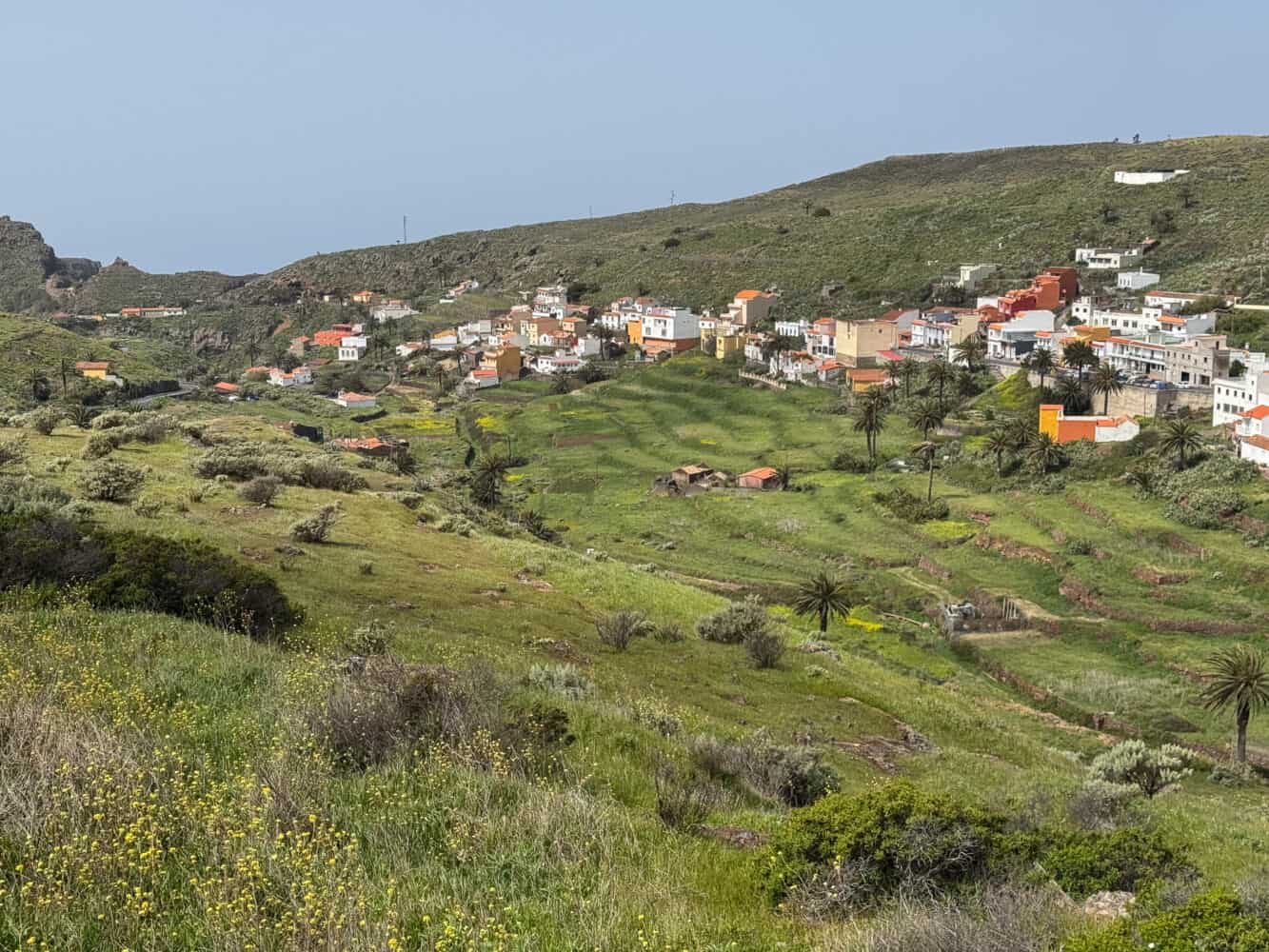
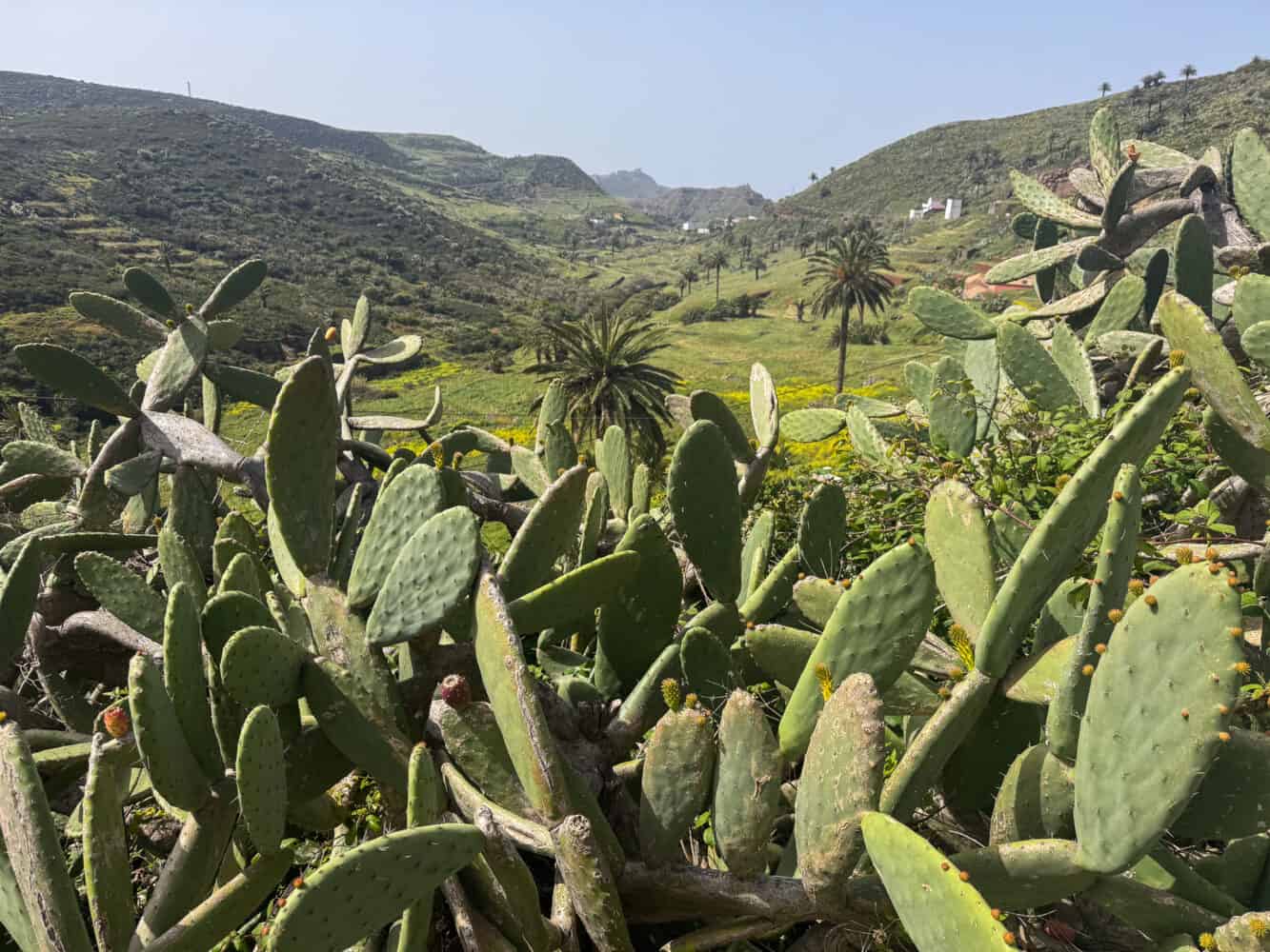
2) Valle Gran Rey Coastal Walk

Walking along the coast in Valle Gran Rey is more of a stroll than a hike as it’s paved. It’s a good option if you just want to stretch your legs and explore the different beaches.
We stayed in Valle Gran Rey for most of our trip. It’s the closest thing to a beach resort on the island, with sunnier and much warmer weather than the centre of the island.
It’s in the southwest, a 1 hour and 20 minute drive from the capital, San Sebastian de La Gomera, via the mountainous interior.
You approach the town by driving down a winding road through a dramatic barranco (river gorge) towards the sea, past terraces lush with green palms and villages of colourful houses.
It’s one of the most beautiful parts of the island. There are a few viewpoints where you can stop to enjoy the view, such as Mirador de la Curva del Queso.
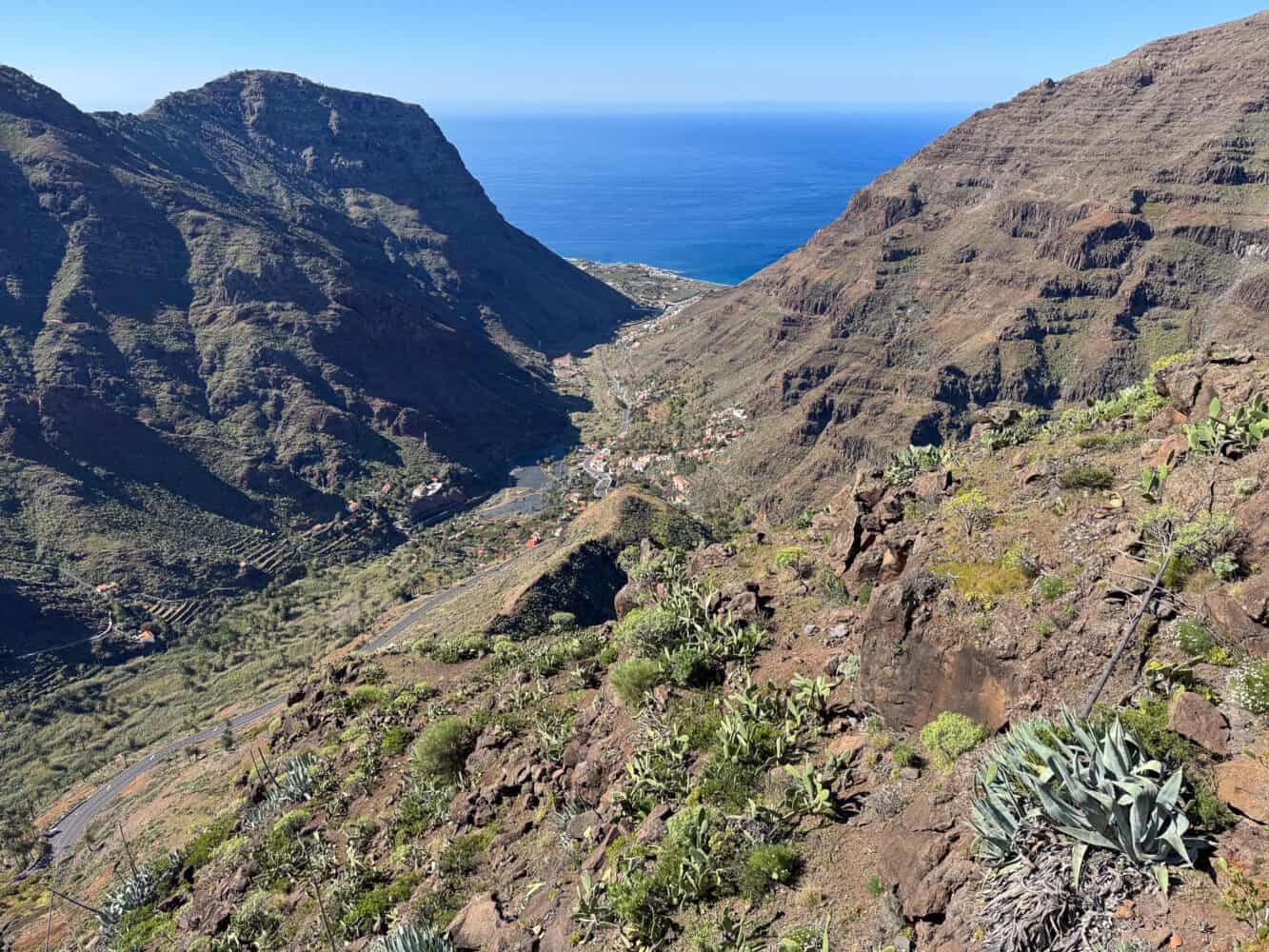
The town is more touristy than the others we visited, but tourism is very lowkey here, and it has a relaxed feel.
The beaches are some of the best on the island (although La Gomera is not really a beach destination), especially if you want to swim.
I loved swimming in the sea after a morning walk. The sea temperature was 20ºC in March—chilly for Simon, fine for me.
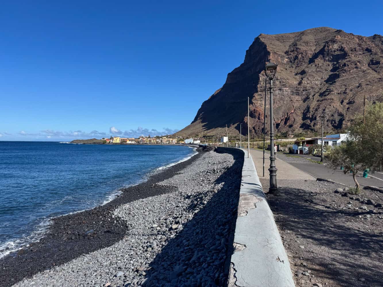
Walking the coast road is a good way to see all of Valle Gran Rey’s beaches. From one end to another takes about 40 minutes each way.
You can start in the middle, as we did, but here are the beaches you’ll pass from north to south:
- Playa del Ingles – The most dramatic, wild beach with black sand and pebbles under cliffs. It’s too rough to swim, but it’s fun to watch the waves and the many red crabs sunning on the rocks. It was a 20-minute walk from our hotel, Hotel Gran Rey.
- Playa de la Calera/ Playa de Valle Gran Rey – The main beach is the longest. It’s more pebbly than sandy in the winter, but there’s a patch of sand near the beach bars (we enjoyed a coffee with a view at La Machanga). Swimming is generally safe here, but check the flags.
- La Puntilla – This is the other end of the main beach. It’s rockier, and the swimming is slightly rougher, but I swam here as it was opposite our hotel. There are a few good restaurants nearby. We liked Il Grillo Parlante for pizza. Mahalo has delicious, healthy food like a tempeh bowl, but you need to book, and the service was incredibly slow on our visit.
- Playa del Charco del Conde – This little sandy beach has a calm, natural pool. It’s good for kids and dips, but it’s too small for real swimming. You can get good ice cream at Heladeria La Crema opposite.
- Playa De Vueltas – This small sandy beach at the port is often protected from the wind. The sea is calm, but the many moored boats make longer swims tricky. The nearby Heladería El Sueño de Yanini is good, and it’s next to a little vegetarian cafe (too busy for us to get in).
If you want a break from hiking, the other major activity in Valle Gran Rey is whale watching. Small boat trips depart from the port and last 3-4 hours. Oceano and Escursiones Tina are the main operators, but the rough sea on our trip put us off.
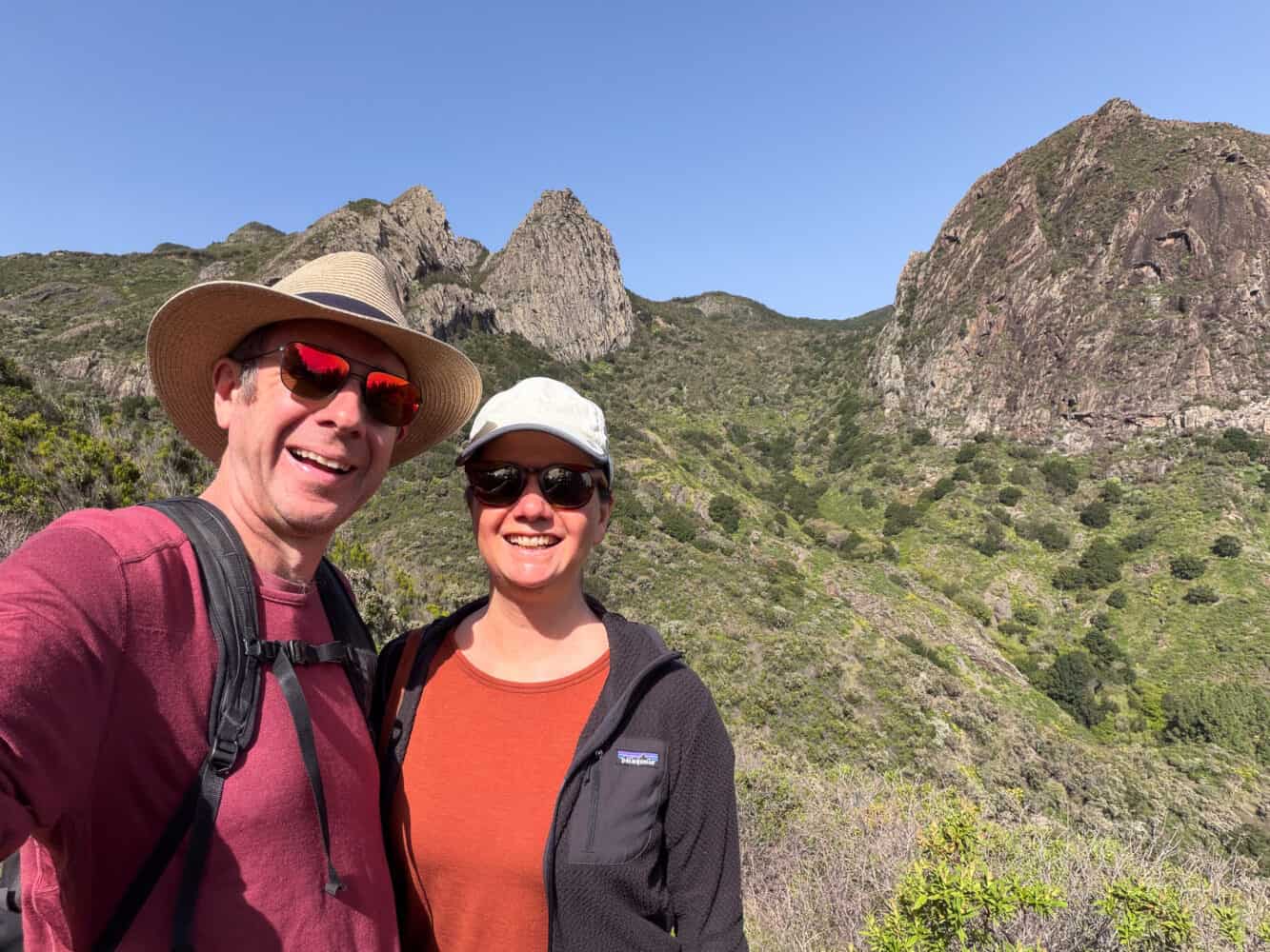
3) Roque de Agando to Casa del Manco
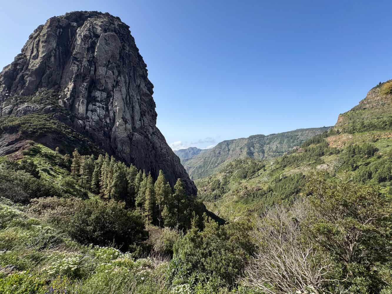
Roque de Agando is a volcanic rock formation in the centre of the island, surrounded by other peaks called Los Roques.
You can drive up for a look at Mirador de los Roques, but manage your expectations. When we first drove past, the rocks were totally obscured by clouds.
On our last day, we tried again and took a beautiful hike on a sunny morning, but clouds were already quickly gathering as we left.
We parked at the viewpoint just before Mirador de los Roques, right next to Roque de Agando. It was a 30-minute drive from San Sebastian La Gomera (where we stayed at the end of our trip).
It’s not marked on Google Maps, but it is on the AllTrails hike we did—Agando – La Laja – Agando.
The name is a bit misleading as you don’t go all the way to La Laja. I really wanted to do the much harder loop that goes to the village (Mirador de la Laja – Casa del Manco on AllTrails), but I wasn’t feeling well enough for the 667m elevation gain.
Instead, our short section of the trail took us down the hill to Casa del Manco (an old ruin of a house) and back up the same way.

The 3km out-and-back route took us 65 minutes, with 229m of elevation gain. The climb back up is steep, but it only took about 30 minutes and is manageable if you take breaks.
I’m sure the full loop is stunning, but if you are short on time or energy, this section is worth doing for stunning views of Los Roques.
It’s partly through the forest at the very edge of the national park, but it looks quite different from the Las Creces area and is also warmer (about 13ºC for us, but that felt hot in the sun).
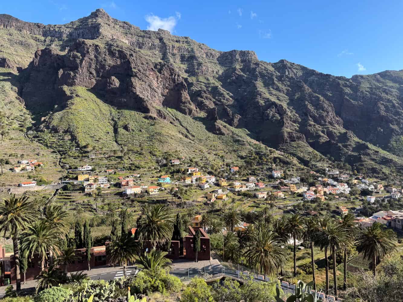
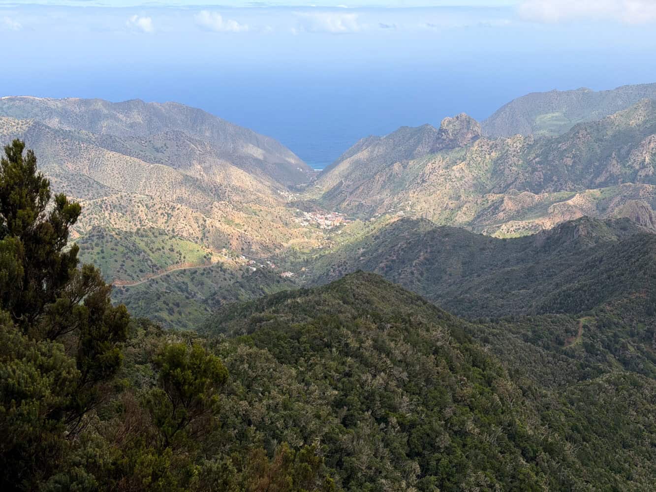
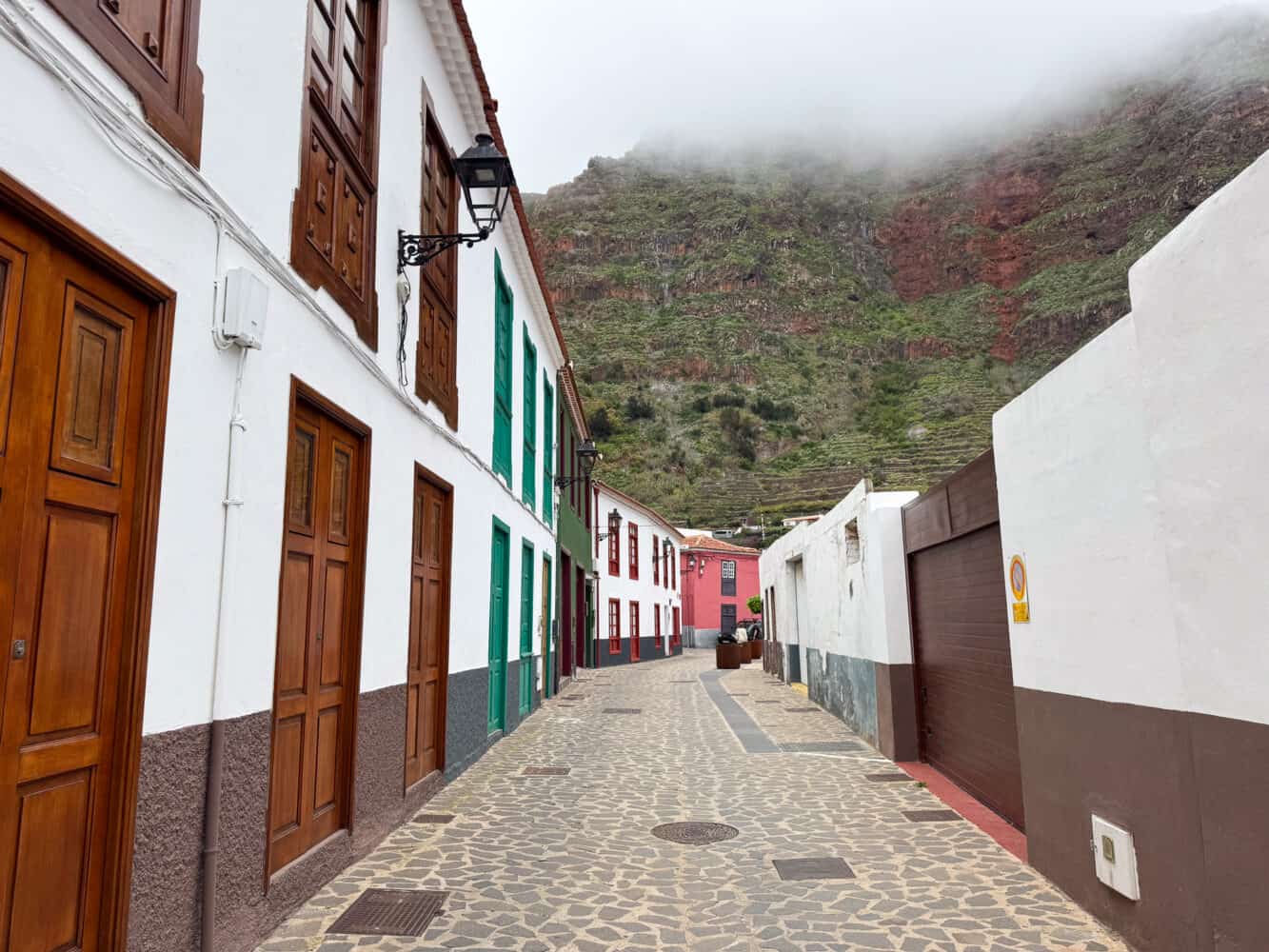
4) Vallehermoso to Presa de la Encantadora
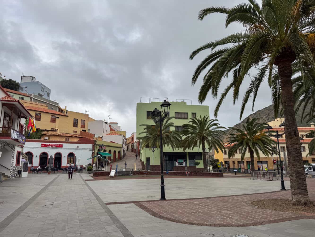
Vallehermoso is a village in the northwest of La Gomera. As always, it’s reached by a dramatic winding drive down a terraced valley. It’s one of the most stunning parts of the island.
It usually takes about 50 minutes from Valle Gran Rey, but the outward journey took us longer as we got stuck in roadworks several times.
Although it’s not quite as cold as the centre of the island, it was still cooler (15ºC) and cloudier than the coast. But at least we could see something—it was a full whiteout when we drove through the national park.
There are lots of hikes from the village, but they are all steep. We did the only moderate one listed on AllTrails—Vallehermoso – Presa de la Encantadora – Los Chapines.
It was my favourite hike on the island, even with grey, drizzly weather.
We started in the main square, Plaza de la Constitución, with a coffee at one of the bars. There’s a free parking lot nearby, or we had to find street parking.
The 4.7km hike took us 1 hour and 20 minutes with 266m elevation gain.
It starts with a steep climb for about 30 minutes as you leave the village with views of terraced gardens, palm trees, colourful houses below, and the rugged mountains beyond.
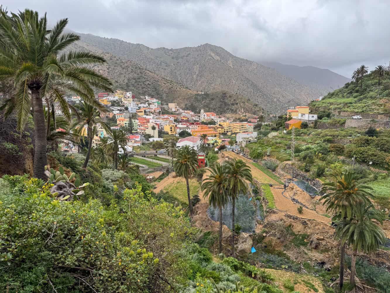
At the top, there’s an impressive view of the dam, Presa de la Encantadora.
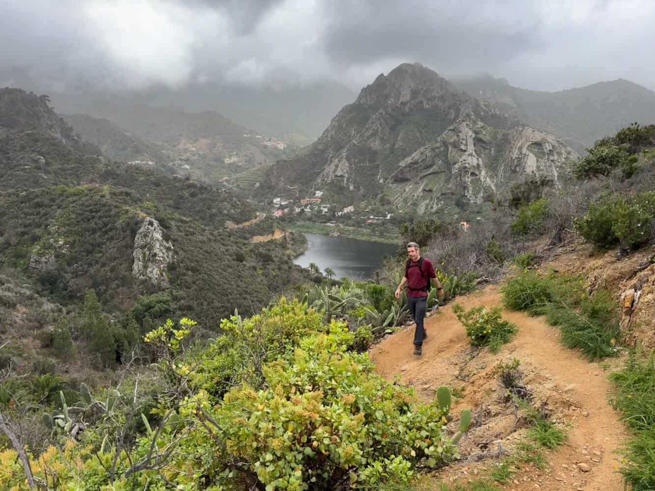
The trail down is rocky and steep, but not too bad when it’s dry (good shoes are a must, poles might help).
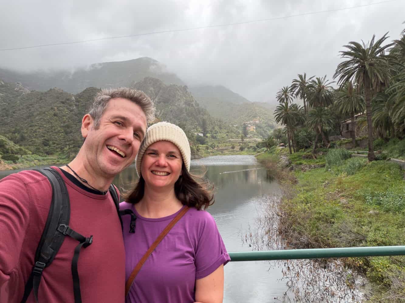
You then cross the dam and walk back to the village for 20 minutes along a quiet road with more lovely views.
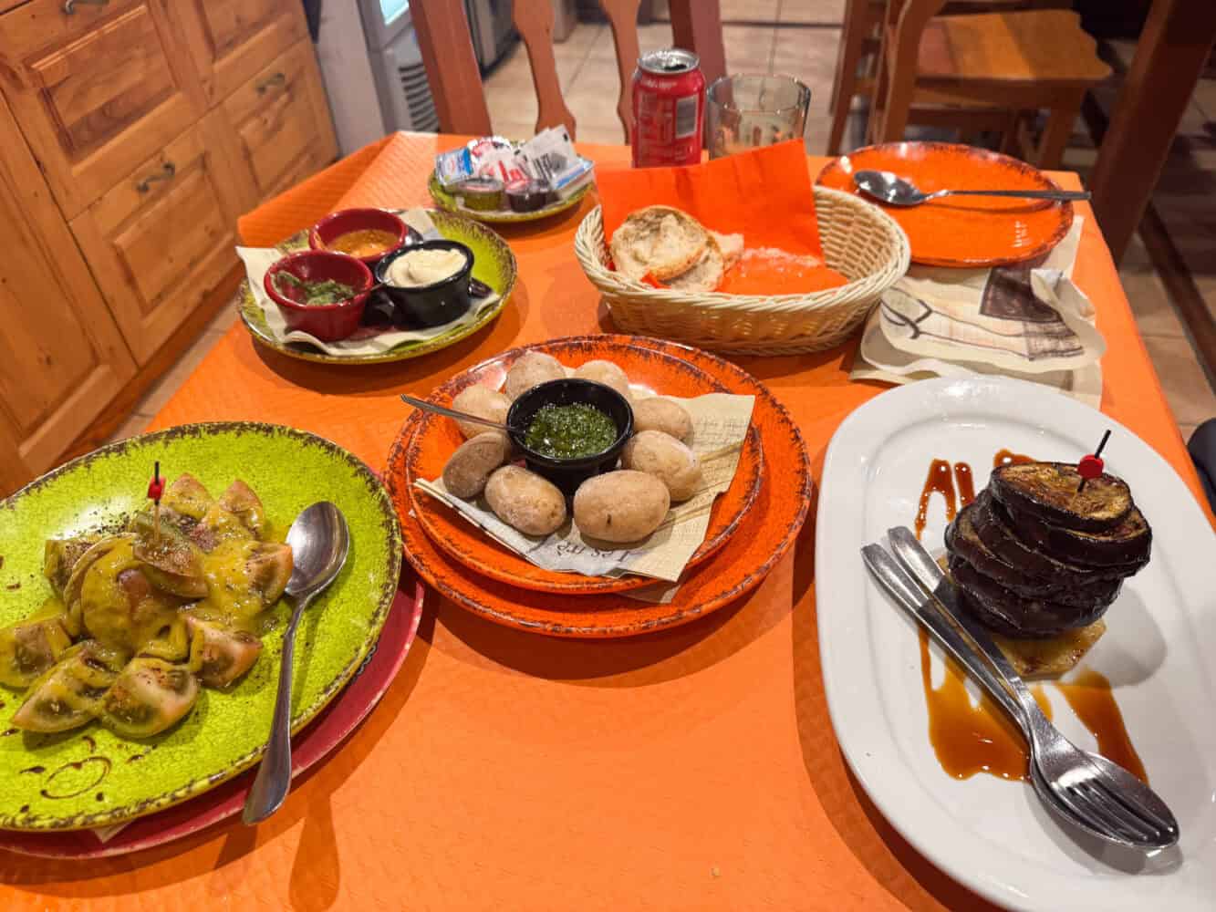
Back in the village, we had an excellent lunch at Tasca El Carraca. The papas arrugadas with mojo and grilled aubergine (an unusual veggie option) were especially good.
5) Arure to Mirador Los Barranquillos
This walk from Arure isn’t a must-do, but it was pleasant and easy.
We chose it when we wanted an easy walk near Valle Gran Rey (it’s a 20-minute drive up the mountain) with clearer weather than the national park (which was very cloudy).
The walk is #32 in the Rother book and is 6.9km with 220 metres of elevation gain. They estimate 2 hours, but it took us a little less than that, even with a few wrong turns.
It starts at Casa Conchita restaurant in the village of Arure. The route is a mix of green valley and forest, leading up to two viewpoints in the national park (you can also drive to these) before looping back down a different way.
Other Hiking Areas in La Gomera
The main hiking area we missed was Hermigua and Agulo, two neighbouring villages in the northeast of the island.
We drove to Agulo on our way back from Valle Gran Rey to San Sebastian, but we only stopped for a short stroll.
Agulo is known as the prettiest village in Spain, with its cobbled streets and 18th-century Canarian architecture (which reminded us of Latin America).
I think that’s overselling things, but it does have a beautiful location between the mountains and the sea.
The drive here was quite arduous, but it would have been more worthwhile if we had hiked in the area.
What to Eat in La Gomera
If you have worked up an appetite while walking, here are some local dishes to look out for on La Gomera.
- Almogrote – A spicy dip made from goat’s cheese, peppers, tomatoes and garlic. Often served with bread as a starter.
- Mojo – These spicy sauces come in green or red versions and are often served with bread or potatoes. Delicious!
- Papas Arrugadas – Small wrinkly potatoes boiled with their skins on and served with mojo.
- Queso Gomero – Local cheeses are made from sheep or goat’s milk and are often served grilled with miel de palma.
- Miel de Palma – Palm honey is sap from the Canarian palm trees you see all over the island. It’s used in desserts or drizzled on cheese and vegetables.
- Potaje de Berros – This soup is made from watercress and gofio, a Canarian flour. The stock is unlikely to be vegetarian.
You’ll also find plenty of fish and meat dishes, but as vegetarians, we skipped those. Valle Gran Rey has the most restaurant options if you have dietary needs.
Our favourite restaurant was Tasca El Carraca in Vallehermoso. The mojo was the most flavourful we had, and they had a few vegetarian dishes beyond the usual cheese and potatoes.
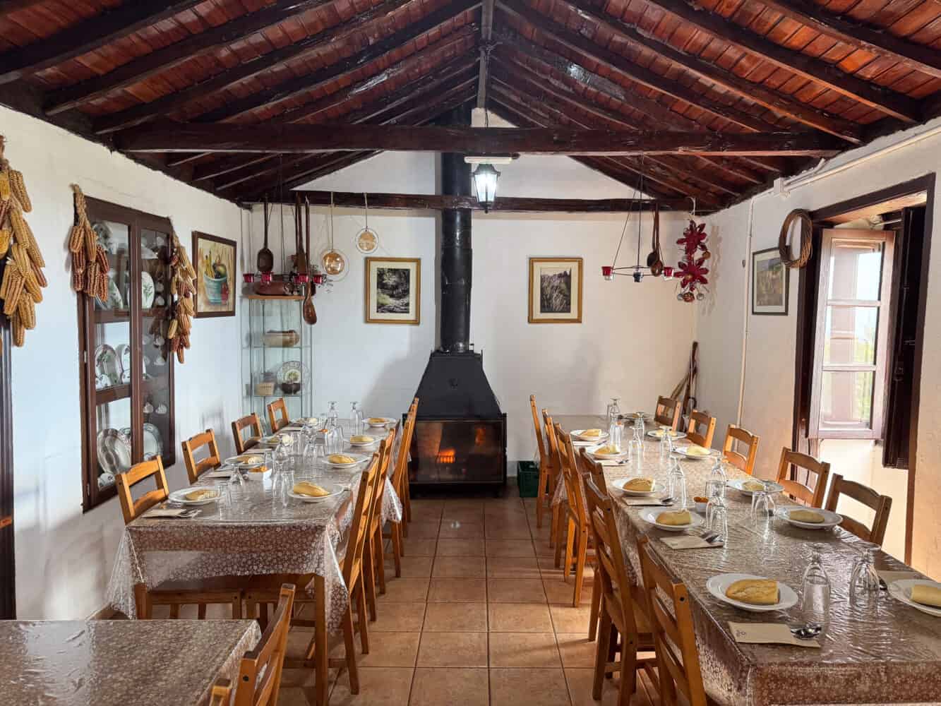
For the most vegetarian options, try Casa Efigenia La Montaña in Las Hayas up in the mountains near the national park.
It’s entirely vegetarian with a focus on traditional local dishes. The set lunch for €12 is good value, including almogrote, a gofio hummus, salad, a main of watercress soup or vegetable stew, and dessert.
The food was simple and hearty but not quite to our tastes.
Where to Stay in La Gomera
When considering the best place to stay for hiking in La Gomera, Vallehermoso and Hermigua are most often recommended, as they are close to many hiking trails and not too far (about 30 minutes) from the national park.
The downside of these towns is that they are at a higher elevation and are colder and often cloudier than the coast.
As I wanted some sun and to swim in the sea, I chose Valle Gran Rey as our main base. I have no regrets as it’s a beautiful area.
We spent 5 nights there and then the last 2 nights in the capital, San Sebastian La Gomera, so that we were close by for our 7am ferry on departure.
Here’s where we stayed:
Hotel Gran Rey
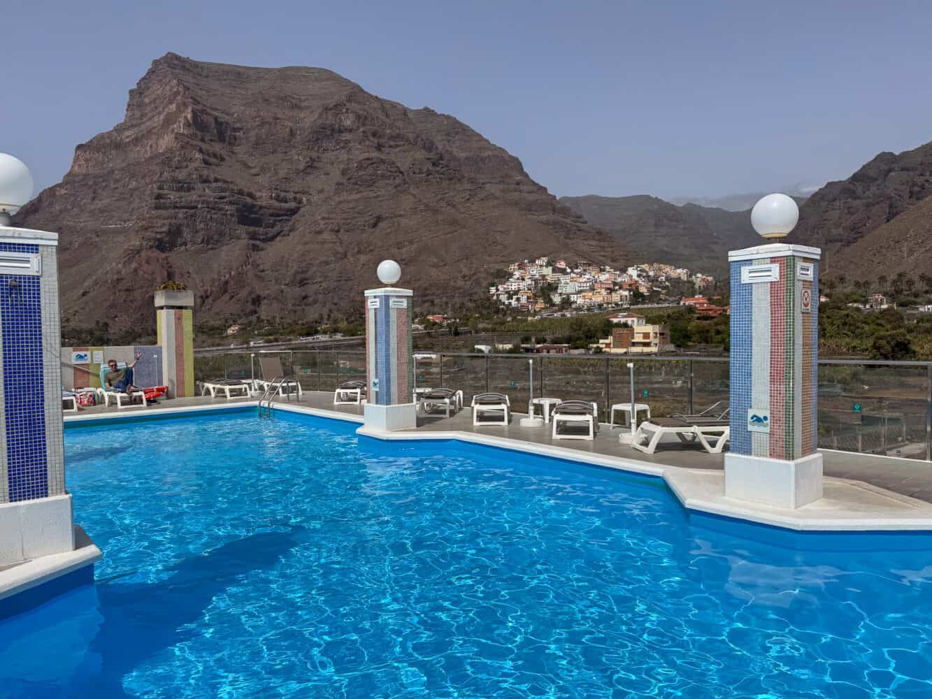
Hotel Gran Rey is probably the nicest hotel in Valle Gran Rey, but it’s still a midrange option.
We didn’t get the best first impression, as they gave us a room next to one undergoing noisy building works. The hotel was full, so they couldn’t give us another room. The worst thing was that they were unapologetic about this, so it wasn’t a great start.
After a few days, when the work had stopped, we ended up enjoying our stay.
The positives are the sea view rooms with balconies, the rooftop pool with lovely views, and the location across the road from a beach (pebbly, but I enjoyed swimming here).
Breakfast is served at the rooftop restaurant and had a good selection (including freshly squeezed orange juice), although it was a little crowded.
Rooms are simple but fine, and we appreciated details like a drying rack on the balcony. There’s a fridge, but no kettle (you might be able to request one).
The cleaning station for hiking shoes outside was also very handy.
Parador De La Gomera
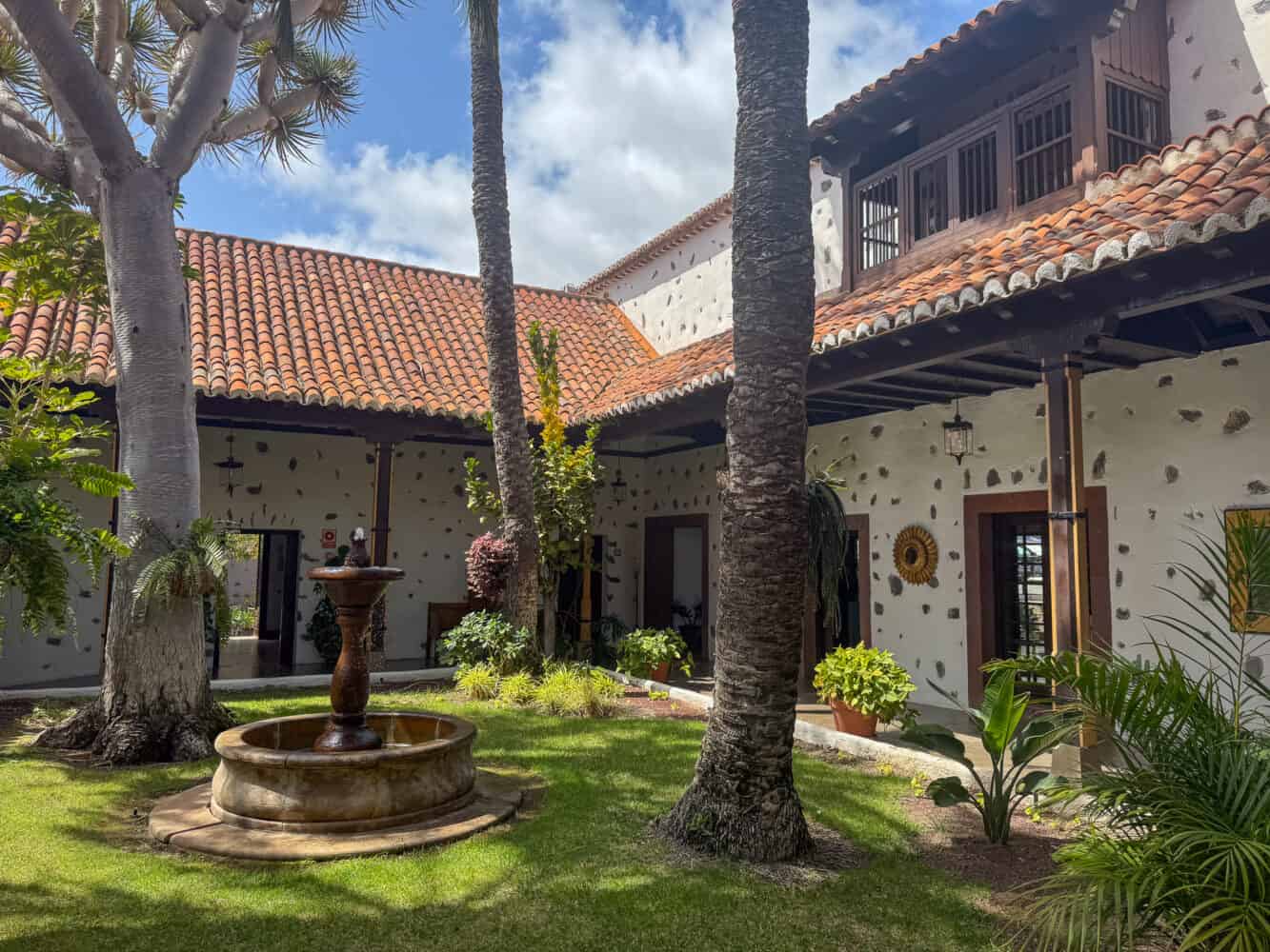
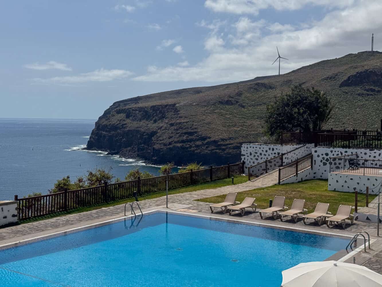
Parador De La Gomera is one of the nicest hotels on La Gomera. The historic building has a beautiful location on a cliff above San Sebastian La Gomera, with lovely gardens and a pool with sea view.
While the building itself feels grand, our room (with twin beds, like everywhere on the island) felt rather austere. It had a kettle and a minibar.
We didn’t like that you had to book a time for breakfast, but at least the food was good.
We skipped dinner at the upscale restaurant and just grabbed a pricey pizza at the bar (which took forever to arrive, but that’s common on the island).
The hotel is a 15-minute walk into town (up steep steps on the way back). A taxi cost €10, which we took to the ferry port (after dropping off our car the previous day).
While I’m glad we didn’t spend our whole trip here, we enjoyed it for a few nights, and it was convenient being close to the ferry.
Getting to La Gomera
Flying
La Gomera does not have an international airport, and the nearest one is on neighbouring Tenerife.
We flew from London Gatwick to Tenerife South (TFS) with British Airways. Many low-cost carriers fly here from across Europe as it’s a popular holiday destination.
At the airport, we joined the long taxi queue (which only took 20 minutes in the end) and took a taxi to the port, Puerto Los Cristianos, a 20-30-minute ride depending on traffic.
The driver used the meter, and the fare was €32. There are a few Ubers, but they were twice the price.
You can also take a bus to the port.
Ferry
From Puerto Los Cristianos on Tenerife, it’s a 50-minute ferry ride to San Sebastian de La Gomera.
Two companies operate on the route—Naviera Armas and Fred Olsen. Both have similar large ferries with plenty of seating and a cafe, so just choose whichever one is next.
We bought tickets at the port (we needed passports to do this) for €46 each one way.
The crossing was pretty rough on the way out but calmer on the way back.
Getting Around La Gomera
On the island, it’s best to rent a car, but it is possible to get around by bus (limited schedules) and taxi. San Sebastian has the most bus options.
As usual, we booked our car via Booking.com and ended up with Avis at the port in San Sebastian.
Collection was easy, and we dropped the keys in the box on departure.
Our Polo was a bit beaten up, but at least it had CarPlay.
La Gomera Map
Is La Gomera Worth Visiting?
La Gomera is definitely worth visiting if you are looking for quiet trails, diverse scenery from desert to forest, and spectacular views.
It did give us the winter sun we were looking for, although not in the centre of the island, where it was usually cloudy and chilly.
As La Gomera is remote, you have to expect a more rustic experience than on the neighbouring Canary Islands. Service was slow, the hotels aren’t fancy, and there’s not much variety in restaurants.
But if nature and peace are your priority, La Gomera is a fantastic choice.
More Hiking Posts
Here are our guides to some of our other favourite hiking destinations:
Enjoyed this post? Pin for later!
